

Publications


Publications and Reports
2019 Youth Environmental Education Program Report
2019 Better Beaches Program Report
Fort Point Channel Watersheet Activation Plan
The Power of Water
In 2009 for the 20th Anniversary of the Massachusetts Environmental Trust, Bruce Berman, Director of Strategy and Communication at Save the Harbor/Save the Bay, presented The Power of Water.
Click here to download a pdf of The Power of Water
Boston By Boat Interim Report
Boston By Boat is a special project by Save the Harbor/Save the Bay. It was designed in 2009 to assess existing passenger water transportation services in the Boston Harbor Region and to determine how best to strengthen and promote commercial and recreational passenger vessel use by commuters, local and regional residents, businesses, institutions, and tourists.
The Boston By Boat Interim Report provides information on the state of passenger water transportation, including commuter services, water taxis, excursions like harbor tours, dinner cruises, and whale watches, and seasonal ferries to Provincetown, Salem, and the Boston Harbor Islands National Park.
Download the Boston By Boat Interim Report
Visit the Boston By Boat website
The Leading Edge: Boston Harbor’s New Role in the City’s Economy
In 2004, Save the Harbor/Save the Bay published a report in partnership with the City of Boston and The Boston Foundation’s Indicators Project to measure the direct economic contribution of Boston Harbor and the waterfront
Today, Boston Harbor “the natural foundation on which Boston’s economy was first built” is once again at the center of the City’s future. Residents from across the city and region are reconnecting to the Harbor and the waterfront in new and exciting ways.
The re-emergence of Boston Harbor and the waterfront as the City’s leading center of growth has happened in large part because of the massive public investments during the past 30 years in the Harbor itself and in the waterfront that surrounds it.
Download a copy of The Leading Edge on the economic impact of the investment in Boston Harbor and our waterfront.
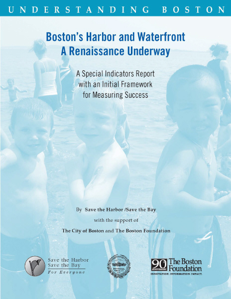
Boston’s Harbor and Waterfront: A Renaissance Underway
In 2005, Save the Harbor/Save the Bay, together with the City of Boston and the Boston Foundation, published a report outlining indicators to track the growth and viability of Boston’s Harbor and Waterfront following a time of large public and private investment in the waterfront city-wide.
Regarded as the filthiest harbor in the nation in the 1980s, today Boston Harbor is among the cleanest, with a Waterfront that is more dynamic than it has been in generations, following an unprecedented investment of close to $20 billion dollars in the environment and transportation systems.
However, none of these improvements guarantee that Boston’s Waterfront will thrive, or that the benefits of the enormous public investments that have been made will be shared by Bostonians of all ages, races and ethnic backgrounds and from every neighborhood in the city.
Save the Harbor/Save the Bay, in partnership with the City of Boston and the Boston Foundation, offers this framework of goals and measures, or indicators, to focus attention and resources on the many ways that Boston and the region can continually improve all aspects of the Waterfront and ensure that all residents of Greater Boston will benefit from the renewal and restoration of Boston’s Harbor and Waterfront.
Download a copy of the Boston Harbor Indicators Report.
Why Beaches Close
In March of 2004 Save the Harbor/Save the Bay’s Science Advisory Committee released its report on the causes of the beach closings in South Boston and Dorchester. This report provided critical information to better evaluate the proposed solutions to the problem.
Download a copy of our 2004 Beaches Science Report “Why Beaches Close”.
In April of 2004, the Massachusetts Water Resources Authority’s Board of Directors voted unanimously to approve a comprehensive solution to the problems that led to regular beach closings in South Boston and North Dorchester Bay, and submitted it to the regulators for review and the court for approval.
The plan that provided a 5-year level of storm water control and a 25-year level of CSO control on the beaches.
Read a Boston Globe news story on the plan.
Download a Boston Globe Editorial in support of the plan.
In 2011, the North Dorchester Bay Storage Tunnel and Related Facilities project was completed. Since the project’s completion, beaches in South Boston have become among the cleanest urban beaches in America.
Read a Boston Globe news story about the completed project.
Outer Brewster Island Preserved
On September 16, 2005, Virginia based AES Energy announced its plan to turn Outer Brewster Island in Boston Harbor into a liquefied natural gas (LNG) terminal. Brewster Island, part of the Boston Harbor Islands National Park, was the fourth proposed terminal along the Massachusetts coast in 2005.
If authorized, the lease of the island would have turned a spectacular natural and recreational resource and seasonal home to important species of sea and shore birds into the largest LNG terminal and storage facility in the nation. Outer Brewster and Calf Bay are also the winter home of the Parks only colony of seals, which often haul out within a few feet of the proposed LNG terminal site after feeding in the productive waters just off Outer Brewster.
Read an Op-Ed from the Boston Globe written by Bruce Berman in opposition to the plan.
Click here to learn more about campaign to save Outer Brewster.